
Set sights on the highest volcano in Southeast Asia. Based on more than a decade of guiding leadership and over 300 summits, I put together this Mount Kerinci trekking information to share the real ground truth from approach to peak.
Planning a trek to the highest volcano in Southeast Asia is a big decision. Rising to 3,805 meters on the border of Jambi and West Sumatra inside Kerinci Seblat National Park, Mount Kerinci demands real physical readiness, mental grit, and end to end precision. I created this Mount Kerinci trekking information hub for those who aiming to scale Sumatra’s highest peak safely and happiness.
There is a specific silence at the crater rim right as the first light of the sun hits the volcanic ridge. In that moment, the cold wind and exhaustion fade away, replaced by a deep sense of achievement. Since starting as a porter in 2013 and founding Kerinci Paradise, I have reached this summit more than 300 times and watched the weather and terrain shift every single day. My goal here is to share practical local knowledge so every hikers can return down the mountain safely with a smile.
Located on the border of Jambi and West Sumatra under the authority of Kerinci Seblat National Park (TNKS), Mount Kerinci sits inside a massive UNESCO World Heritage rainforest ecosystem. Trekkers can approach the summit through two completely different realities: the direct southern push from Kersik Tuo or the deep northern rainforest circuit from Solok Selatan.
Because our team operate across both gateways, We mapped this terrain using GPS recorded data. Whether pacing a multi day trek or training for a single push effort, this course profile shows exactly where the lower jungle sections end and the steep volcanic ash push begins.
| Name | Elev. | Dist. | Coords |
|---|---|---|---|
Kerinci Summit 3805 | 3,805 m | -- km | -1.6971, 101.2645 |
Tugu Yudha | 3,676 m | -- km | -1.6993, 101.2642 |
Camp Area Kerinci Paradise | 3,285 m | -- km | -1.7055, 101.2673 |
Hanging Rock | 3,512 m | -- km | -1.7016, 101.2652 |
Shelter 3 | 3,277 m | -- km | -1.7058, 101.2673 |
Shelter 2 | 3,051 m | -- km | -1.7098, 101.2680 |
Shelter 1 | 2,499 m | -- km | -1.7204, 101.2636 |
POS3 | 2,204 m | -- km | -1.7290, 101.2623 |
POS2 | 2,022 m | -- km | -1.7349, 101.2604 |
POS1 | 1,911 m | -- km | -1.7407, 101.2603 |
Start Trekking Point | 1,810 m | -- km | -1.7474, 101.2594 |
Resort Danau Bontak | 1,060 m | -- km | -1.6194, 101.2530 |
Pos Andalas | 1,020 m | -- km | -1.6217, 101.2415 |
Pos Air Terjun Beringin | 1,218 m | -- km | -1.6381, 101.2353 |
Pos Kambing | 1,354 m | -- km | -1.6450, 101.2324 |
Camp Baneo | 1,833 m | -- km | -1.6689, 101.2309 |
Camp Tapir | 2,617 m | -- km | -1.6856, 101.2430 |
Camp Cantigi | 3,212 m | -- km | -1.6908, 101.2533 |
Camp Cadas | 3,473 m | -- km | -1.6929, 101.2566 |
Puncak Bayangan | 3,627 m | -- km | -1.6963, 101.2601 |
In my local community, nobody talks about conquering Kerinci. A living 3,805 meter volcano is never beaten; a place on its summit is earned through humility, preparation, and respect for shifting conditions. When human motion aligns with the right weather window, the massive crater reveals itself at sunrise.
Managing a trek to Mount Kerinci means preparing from arrival to departure. Because every stage affects stamina on summit, understanding Mount Kerinci hiking conditions, overland road, and valley rest is essential before locking in dates.
Sitting near the equator, the volcano creates a dynamic microclimate where Mount Kerinci hiking conditions can shift within minutes. Even during drier months, sudden rain can arrive in the afternoon, while rainy season mornings often open with clear skies and starry nights. Success here comes from understanding seasonal weather rather than simply chasing a dry month.
Although the main trailhead sits in Jambi Province, starting from Minangkabau International Airport (PDG) in Padang is the most practical option. From Padang, the overland travel to Kersik Tuo takes 7 to 9 hours depending on road traffic.
Using private transport gives guests the flexibility of pickup from either the airport or Padang city. In my experience, arranging a pickup no later than 10:00 AM is the wisest move so there is plenty of time to recover in the valley.
Arriving in Kersik Tuo at roughly 1,400 meters one day ahead of the trek is far better than rushing onto the trail after a long drive. The village offers a wide range of valley stays, from local homestays and hotels to resorts that match different comfort preferences.
As the highest volcanic peak in Indonesia, Mount Kerinci is defined by steep contours and dense tropical forest, offering only 2 official gateways to the summit. Each Mount Kerinci route delivers a distinct atmosphere depending on past mountain experience and available time.
It is almost impossible to talk about Mount Kerinci without mentioning Kersik Tuo as its main gateway. For decades, this trail has been the primary route and a fundamental part of the mountain’s climbing culture.
This popularity comes from the Kersik Tuo route offering highly efficient duration and distance. Covering more than 2,000m with a 7km distance from start trekking point to the summit, this itinerary is often completed in 2 days and 1 night. The trail offers no gentle approach to the summit.
Due to its popularity and high volume of hikers, the village closest to the trailhead, Kersik Tuo Village, has transformed into the central tourism of Kerinci, bringing the mountain ecosystem to life. Its infrastructure is complete enough to cover essential needs, with a wide range of accommodations from homestays to hotels located close to the trail entrance.
Beyond that, this ecosystem is also supported by an extensive community of experienced guides and porters.
This comprehensive support system allows climbers to arrive without logistical concerns and focus entirely on the ascent.
In sharp contrast to the lively atmosphere of Kersik Tuo, the Via Solok Selatan trail offers a completely different character. This route is specifically aimed at experienced hikers seeking total isolation, dense tropical forest vegetation, and a journey far from the tourist crowds.
To reach the summit, this trail requires at least a 3-day ascent, not including the descent.
The route passes through a truly untouched section of rainforest. Its pristine natural conditions make wildlife encounters a highlight of the hiking process on this trail.
Every step demands complete self-reliance, strong navigation skills, and a deep respect for this remote ecosystem.
For those who wish to experience the true essence of Mount Kerinci in the deep wilderness, this route delivers an authentic atmosphere from start to finish.
Success in reaching the summit and the happiness experienced afterwards are determined long before touching the ground in Kersik Tuo. Minimal preparation is the main obstacle on this mountain.
There are three key principles that must be understood to make sure you’re fully prepared before starting the climb.
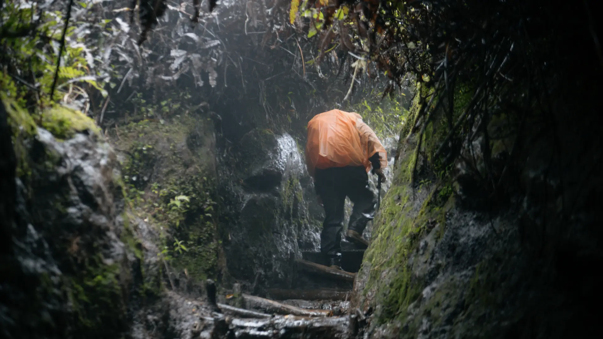
When it’s been hot for 10 days without rain, the Mount Kerinci trail feels relatively easy. However, the weather in this region is highly dynamic and can change very quickly without advanced notice.
One month before your planned climb, focus your training on developing leg strength. Try simulating stair climbing with a 10 kg backpack at least 3 times a week during the last month. If you have extra time, jogging is very effective for building cardiovascular endurance and maintaining a steady breathing rhythm on a route with a constant incline.
“Making Indonesia’s highest volcano your first-ever summit is a big decision. It takes courage and deep trust in the people who walk with you. Thanks to the team, the experience was amazing.”
– Diletta (Italy)
The technical gear used for extreme mountaineering is not needed on Mount Kerinci. However, bringing the right equipment is essential for your safety. Since this climb is generally only for 2 days and 1 night, we highly encourage you to pack your gear as efficiently as possible without leaving behind the essentials.
To keep things efficient without compromising safety, the necessary equipment is categorized into five core elements:
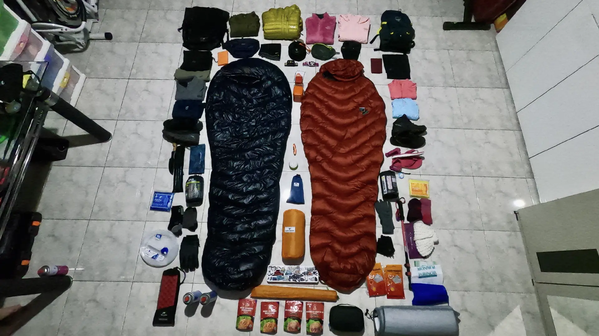
Good physical training and well prepared equipment will build strong confidence to respond to any situation on the trail.
Make sure all your gear has been checked off the Mount Kerinci climbing gear list before leaving home. Even though Mount Kerinci is a popular destination, the availability of personal gear rentals at the base of the mountain is very limited. Preparing everything at home is key to ensuring a smooth climb without technical issues.
In high-altitude mountains, a low price is almost never a benefit; it is often a risk that ultimately leads to far greater costs down the road.
When comparing trekking operators, significant price differences usually stem from hidden compromises. Budget packages often sacrifice essentials such as fair wages for local porters, proper food standards, a safe guide-to-hiker ratio, or even safety and comfort just to force a summit.
In today’s era of digital technology and AI, no operator can hide the cost of every element in the operational chain. That is why at Kerinci Paradise, we practice radical budget transparency.
Within this operational chain, it is not enough to simply know the permit fee for Kerinci Seblat National Park (TNKS), which is IDR 325,000 for international hikers and IDR 45,000 for domestic hikers. There are many other real cost elements within each phase that should be transparently understood, ensuring that what you pay for is purely the quality you receive.
Reaching the summit of Mount Kerinci is a major milestone, and the depth of that experience depends entirely on the team walking beside you.
To fulfill that hope, we provide two distinct options tailored to your needs: If you are looking for our solid operational standard with essential support, the Regular Trip is the right choice. However, if you desire a more exclusive experience, the Premium Trip is your perfect answer.
This active volcano demands respect, and your preparation starts today. Let us know if you have any specific questions. We are here to make your trip More Than Summit.
Whether preparing for a first volcanic ascent or arranging a private group schedule, the local team provides clear, practical guidance prior to booking.
PT KERINCI PARADISE ADVENTURE
RT 06, Siulak Deras Village
Gunung Kerinci District
Kerinci Regency, Jambi Province 37162